

Welcome
The DataHub of the Research Field Earth and Environment open_in_new is a joint initiative of all centers of the Helmholtz Association participating in the research program 'Changing Earth' open_in_new. Three SubHubs (ATMO, MARE and TERRA) assigned to the compartments of the Earth system jointly form the DataHub.
The DataHub brings together the (Earth system) data in the research area Earth and Environment. This process requires a consistent implementation of the FAIR principles open_in_new and opens the data to the outside (openness). It thus represents an offer to all researchers and other users of the data to gain new insights.
Within the DataHub, data management tools are developed and made available, and data products are offered in thematic viewers. The continuous and long-term development process of these solutions is the DataHub's task. Furthermore, networking of the DataHub with other national (e.g. NFDI open_in_new) and international initiatives (e.g. EOSC open_in_new, RDA open_in_new) takes place.
Spotlights
Explore interactive maps and data products related to the topics of the research program in the Research Field Earth & Environment.
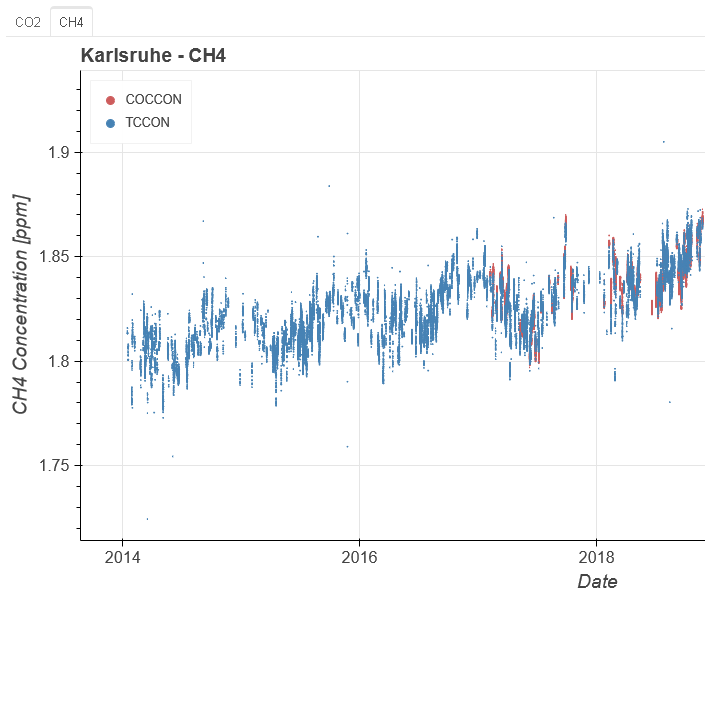 Greenhouse gases
The concentration of the greenhouse gases carbon dioxide (CO2) and methane (CH4) in the atmosphere continues to increase. The time series of the measuring stations of the KIT document the long-term development.
 MOSES
MOSES
Modular Observation Solutions for Earth Systems (MOSES) is a novel observing system, jointly developed by Helmholtz Centres in the research field "Earth and Environment".
 Boknis Eck
The Eckernförde Bay through the ages: More than six decades of biogeochemical measurements.
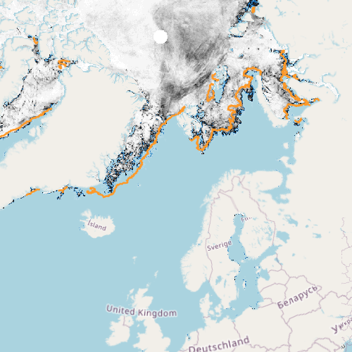 Sea Ice
Observations of sea ice concentrations and its seasonal as well as long-term changes in the Arctic and Antarctic provide important insights into the influence of climate change on the polar regions. Sea ice is an important indicator of global climate change.
 Earthquakes
Strong earthquakes can have devastating effects on people and the environment. Here you can find the latest earthquake information from the GEOFON network.
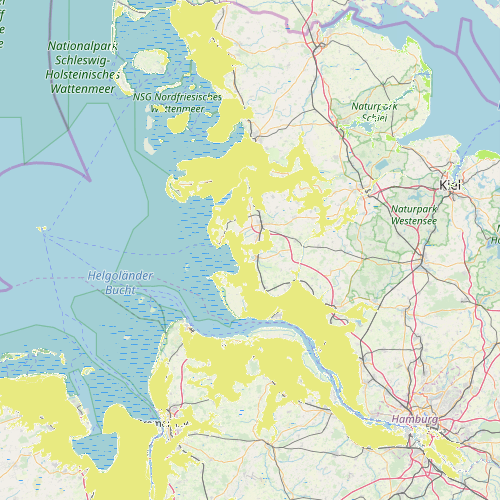 Coastal Protection Demand
Interactive maps for coastal protection requirements on the North and Baltic Sea coasts. You can find out whether your residential area is protected from storm surges by coastal protection today, or whether this will be necessary by 2100.
 Climate Resilience
Weather and climate resilient agriculture requires comprehensive environmental data through monitoring and simulations. In this context, you can view some selected services of the ADAPTER project.
 TERENO
Finding solutions to the impact of global change is one of the most important challenges of the 21st century. TERENO is embarking on new paths with an interdisciplinary and long-term research programme.
 Marine Litter
Within only 50 years, litter has become an increasingly serious threat to the marine environment, aquatic life and humankind.