

DataHub Tools and Services
The participating centers of the Research Field Earth and Environment of the Helmholtz Association developed and are currently developing a variety of viewers and tools to support the work of scientists in many ways. The spectrum of these tools ranges from data management, to analysis tools, to service offerings for the assignment of persistent identifiers. Here is a list of tools already available, and also those still under development at the Helmholtz centers.
Map services
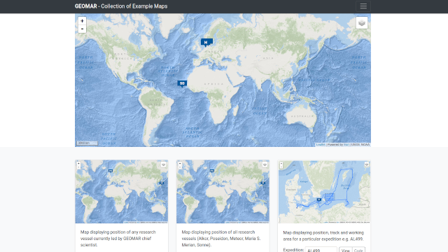
The GEOMAR map services provide maps including expedition related information for integration in other tools.
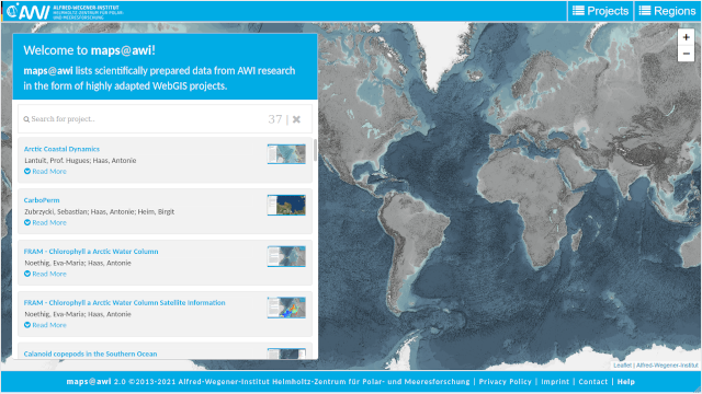
maps@awi lists scientifically processed data in a highly specialised WebGIS project.

Das Zentrale Probenlager (ZPL) und das Gesteinslager des GEOMAR beherbergen eine umfangreiche Sammlung von marinen Sedimentkernen und Gesteinsproben. Der Großteil der Proben wurde auf Expeditionen in allen Weltmeeren gewonnen. Die ältesten Kerne stammen aus dem Jahr 1964 aus der Küstenregion vor Ägypten. Landproben kommen u.a. aus von an Schiffsexpeditionen anknüpfenden Landexpeditionen. Informationen über das Probenmaterial, inklusive Metadaten, werden über die Datenbanken OSIS und PANGAEA bereit gestellt. Eine Kartenanwendung gibt einen Überblick über alle am GEOMAR gelagerten geologischen Proben - Gesteine und Sedimentkerne.

The Earthquake Explorer application was developed at GFZ to provide rapid information on recent earthquakes worldwide as well as earlier earthquakes back to August 2007. It combines a zoomable and configurable map overview of activity with a highly customizable filter with more detailed information on dedicated pages for each event.
The urban AQF Tool displays forecasted air pollutant concentrations for the region of Hamburg in Northern Germany based on a complex model developed at Helmholtz-Zentrum Hereon in Geesthacht, Germany. The tool considers various gaseous pollutants and different pollution sources for largely populated urban areas with intense harbour activities. This data collection provides a synthesis of current air quality issues in Hamburg and is intended to support action knowledge for decision-making.
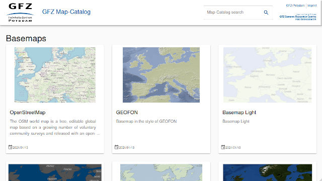
The GFZ map catalog provides maps and geo data via standardised webservice interfaces, such that they can be implemented into other application and tools. Offered are basemaps and thematic overlays that can be enriched by individual maps and geodata.
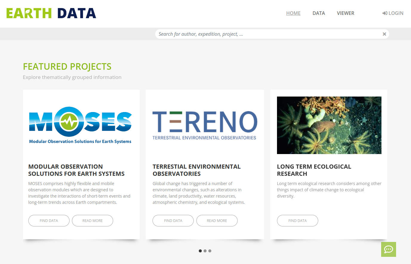
Das Earth Data Portal wird derzeit entwickelt, um das FAIR-Forschungsdatenmanagement zu erleichtern und Forschungsdaten aus interdisziplinären Forschungskooperationen sowie aus individuellen Forschungsinitiativen der Forschungsbereiches Erde und Umwelt zu veröffentlichen, zu visualisieren, zu durchsuchen und zugänglich zu machen.
An integrated cloud-ready spatial data management system.
What Spatial.IO can do for you
Environmental research produces an increasing amount of spatial data (e.g. climate, hydrological, socio-economic) by using a variety of methods (e.g. modelling, remote sensing, data-driven). This leads to the demand for effective management of such data.
This application aims to provide automated workflows and user-friendly applications/interfaces in a cloud-based environment to easily manage, share and visualize standardized spatial data.
Data management
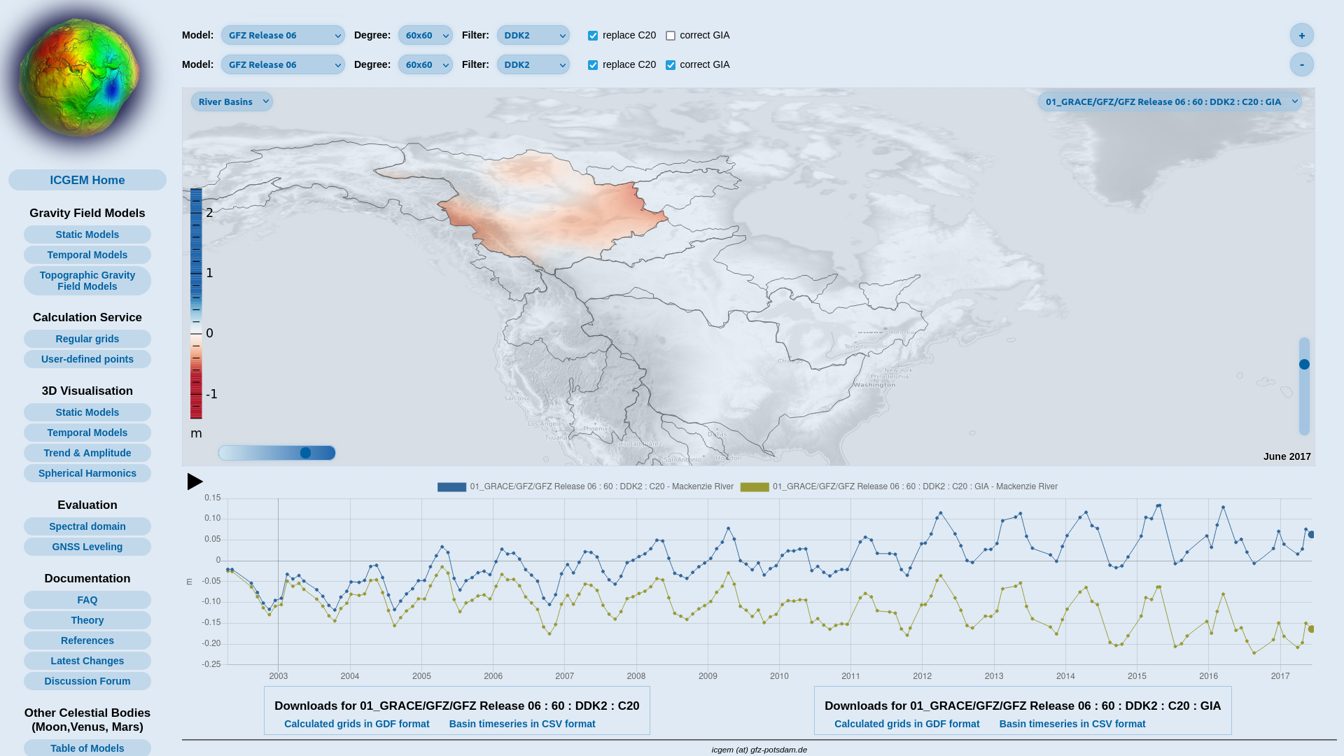
ICGEM wurde 2003 als Dienst unter dem Dach des International Gravity Field Service (IGFS) eingerichtet. ICGEM umfasst die Sammlung und Langzeitarchivierung bestehender globaler Schwerefeldmodelle und Lösungen aus bestimmten Zeiträumen (z.B. monatliche GRACE-Modelle), die Bereitstellung globaler Schwerefeldmodelle in einem standardisierten Format, die interaktive Visualisierung der statischen und monatlichen globalen Modelle (Geoidwellen und Schwereanomalien) und die Unterstützung der Berechnung von Schwerefunktionalen aus den sphärisch-harmonischen Modellen.

Management and repository for administration of device, platform and sensor information.
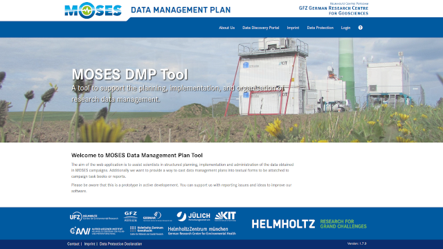
Goal of the MOSES Data Management plan is to help scientists during the structural planning, implementation and administration of data collected during MOSES campaigns. Additionally, the portal offers retrieval of text based data management plans that can be used for tasking documents or campaign reports.The collected information should be transferred automatically to the (MOSES) Data Discovery Portal. The metadata can be further used in other tools via ISO XML (ISO19139).The instrument data input is simplified by providing APIs, which also reduce the number of duplicate entries.

OSIS, developed by GEOMAR and other collaborative institutes, is a data management tool. Expedition related metadata such as maps, route descriptions, weekly reports, DSHIP, published data and stations can be delivered as JSON to external websites. Data published via OSIS links in OceanRep or OSIS expeditions in PANGEA, will be visible in the MareHUB Portal marine-data.de. OSIS furthermore serves as data management plan record, i.e. users will see their deliverables colour coded on the front page. Provisioning of data in OSIS, or the publication of data, are regularly performed at specified periods, and in agreement with the data policy.
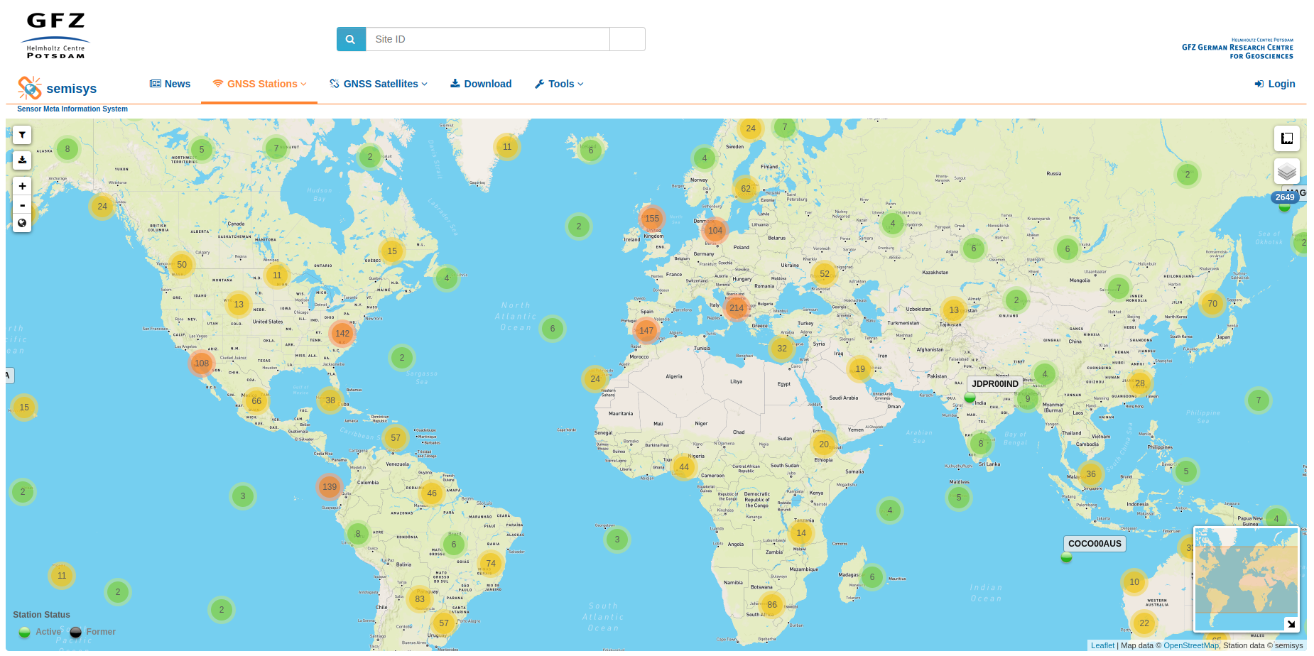
Die hochgenaue Analyse von GNSS-Beobachtungsdaten basiert auf einer Vielzahl von Metadaten aus heterogenen Quellen. Zu diesen gehören Stations- und Satellitenmetadaten. Eine hohe Qualität bei der Auswertung der Daten kann nur durch die Konsistenz und Integrität der Metadaten gewährleistet werden. Das Operational Data Center (ODC) des GFZ hat hierfür SEMISYS (Sensor Meta Information System) weiterentwickelt, das die Metadaten formatunabhängig und validiert verwaltet und bereitstellt. Der Zugriff auf die Daten kann sowohl über eine grafische Weboberfläche als auch über Kommandozeile erfolgen.
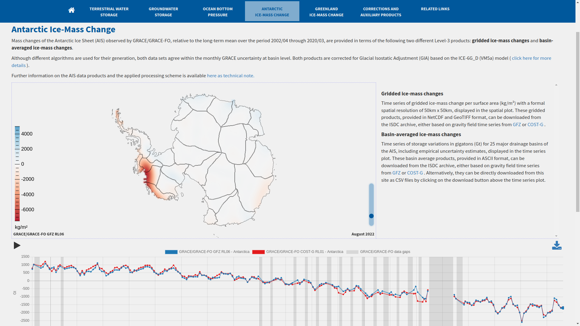
Die von den gravimetrischen Erdbeobachtungssatellitenmissionen GRACE und GRACE-FO abgeleiteten Datenprodukte werden zur Untersuchung von Massenschwankungen im Erdsystem verwendet. Um die Nutzung von Satellitengravimetriedaten für eine breitere Nutzung zu ermöglichen, werden von verschiedenen Institutionen benutzerfreundliche Produkte ('Level-3') erstellt. GravIS visualisiert und beschreibt die Level-3 Produkte basierend auf den jeweils aktuellsten GRACE- und GRACE-FO-Schwerefeldmodellen des GFZ. Die Produkte des GravIS sind zum Download im "Information System and Data Center" (ISDC) des GFZ frei verfügbar.

Das Management von Proben und dazugehörigen Daten ist langfristig mit einem umfassenden Service sicherzustellen. Das Hauptziel ist die Erfassung aller Informationen über die technischen und wissenschaftlichen Arbeiten, die während der Betriebsphase im Feld und im Labor durchgeführt werden. Gut dokumentiertes Probenmaterial wird für die Probenehmer:innen und die anschließende dauerhafte Lagerung aufbereitet. Die daraus resultierenden Ergebnisse liefern grundlegende und validierte Datensätze; eine gemeinsame Referenz, die unverzichtbar ist, wenn die meisten Mitglieder des Wissenschaftsteams ihre wissenschaftliche Arbeit aufnehmen.

Das Sensor Management System bietet als Dienst eine umfassende Möglichkeit, verschiedene Messgeräte, Sensorplattformen und Messkonfigurationen zu beschreiben und zu verwalten sowie die spezifische Einrichtung und Konfiguration von Geräten und Mess-Setups bspw. in Observatorien oder auf Messkampagnen zu dokumentieren, während Daten aufgezeichnet werden. Informationen zu spezifischen Setups können zusammengefasst und als Metadaten zusammen mit den Daten für wissenschaftliche Auswertungen zur Verfügung gestellt werden, wodurch die Datengenese über die Provenienzverfolgung dauerhaft nachvollziehbar und transparent wird.
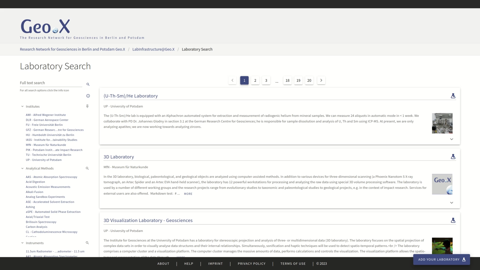
LI2 stellt in der Forschung genutzten und zur Verfügung stehenden Laborinfrastrukturen dar und unterstützt so ein gemeinsames und umfassendes Laborinfrastrukturportfolio. Eine rollenbasierte Kuration ermöglicht die Aufnahme und Bereitstellung von Informationen zu Laboren, Instrumenten und Methoden und diese in einem Suchportal zur Verfügung. Aktuell wird der Dienst als LabInfrastructure@Geo.X angeboten und soll nach erfolgreicher Einführung einer breiteren Wissenschafts-Community im Kontext der NFDI geöffnet und zur Verfügung gestellt werden.
Data publication and PIDs
GFZ Data Services is a repository for research data and scientific software across the Earth System Sciences, hosted at GFZ. The curated data are archived, persistently accessible and published with DOI. They range from large dynamic datasets from global monitoring networks with real-time acquisition, to international services in geodesy and geophysics, to the full suite of small and highly heterogeneous datasets collected by individual researchers or small teams ("long-tail data"). In addition to the DOI registration and data archiving itself, GFZ Data Services team offers comprehensive consultation by domain scientists and IT specialists.
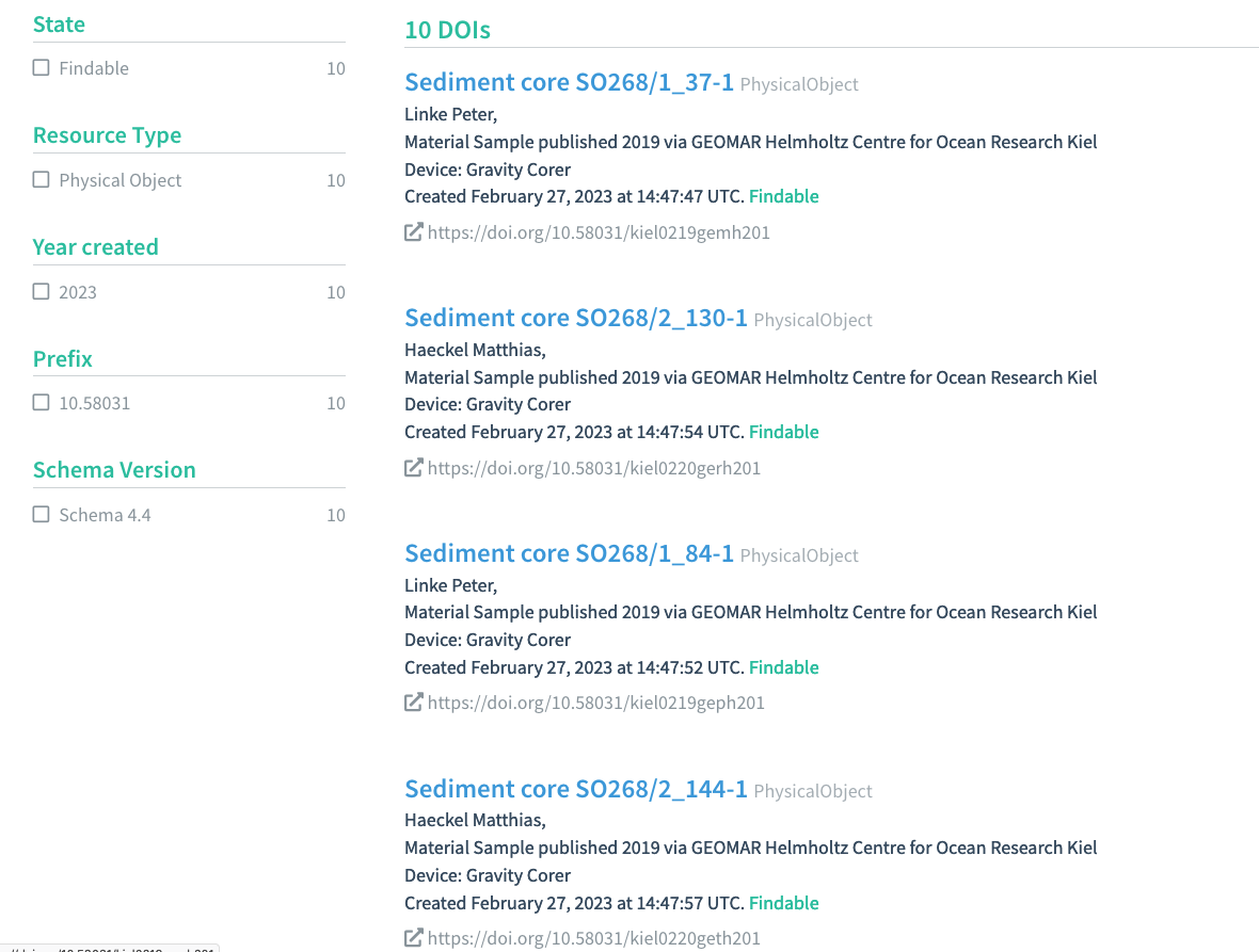
As an International GeoSample Number (IGSN) member, the GEOMAR together with Kiel University offers a registry service for the retrieval of IGSN names. Samples with an assigned IGSN are uniquely identifiable and referable. The samples can be accessed via the GEOMAR services, to simplify their utilisation. The services include distribution of IGSN, application of namespaces, provision of an OAI-PMH interface for metadata aquisition, support for the implementaiton of best practices for IGSN-distribution, -syntax and -metdata, securing the uniqueness of a registered IGSN, the permanent access to metadata and their persistence.
GFZ is founding member and allocating agent of the IGSN International Generic Sample Number (IGSN) and offers IGSN registration and catalogue services. IGSN is a globally unique and resolvable persistent identifier for physical objects with discovery functionality in the internet. The IGSN on the sample links to its online sample description and facilitate the establishment of cross-references between samples and the data derived from sample analyses. GFZ’s IGSN Service includes the registration of IGSNs and comprehensive consultation on best practices for sample metadata and discovery. From 2023 on, IGSNs will be registered as DataCite DOIs.
Data analysis
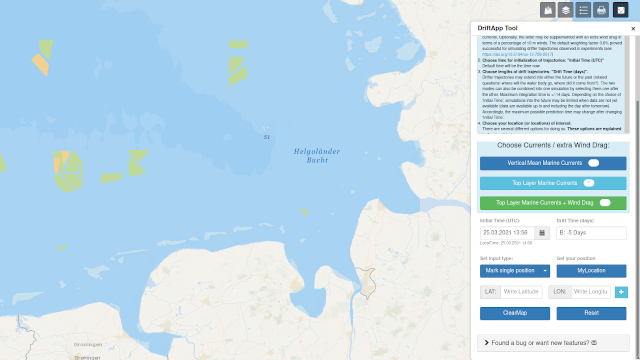
For a profound interpretation of measured data, such as collected at permanent stations or campaigns, it is vitally important to understand the history of the targeted water bodies. Using the Drift App of the Helmholtz-Zentrum Hereon, drift pathways of such water bodies can be computed on a daily base utilising operationally generated flow fields.

Monitoring and display of (e.g. real time) data accompanied by maps and diagrams.
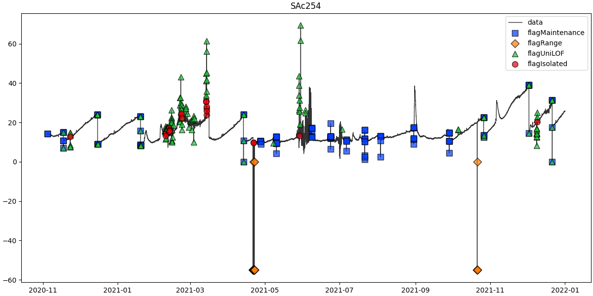
A consistent, extensible, easy-to-use tool to quality control time series data fully automated. For this purpose, there are many testing and correction algorithms available, which could be used in an objective and fully reproducible manner (by means of metadata). SaQC is currently used to detect anomalies in the more than a billion observations of the UFZ observatories and to clean them up. The tool will be perspectively in use also in the time series management for additional observatories of FZJ and KIT.
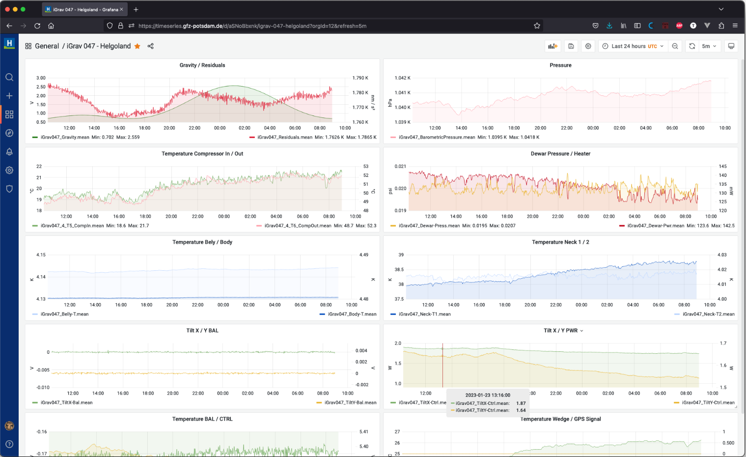
Timeseries are an integral part of many research activities and are at disposal as a constantly growing amount of data. The Timeseries Management is a tool for automated importing, handling and visualizing of timeseries data and for the monitoring of the measuring instruments, which collect this data. The visualization is made with diagrams, maps, heatmaps and other figures on dashboards and could be also embedded and made available on external websites and data portals.
Other services
The Microplastic Compendium (MCP) amalgamates the current state of existing knowledge with regard to in-depth analysis of microplastics in the marine environment. Experts from the Helmholtz-Zentrum Hereon, the Helmholtz Centre for Environmental Research (UFZ), the Alfred-Wegener-Institute (AWI) and the University of Plymouth have contributed with content and special articles. A compendium with information-rich information like this is created to address grand challenges to tackle global environmental changes, such as the pollution of the marine environment with microplastics.
The PFAS explorer serves as digital source of information and platform on different aspects of pollution with per- and polyfluoralkyl substances (PFAS). It targets starters in the scientific field and interested users from other areas. Information was gathered on sources, distribution and fate of PFAS in different environmental compartments. Related concerns and potential ways forward are discussed from a scientific but also from a regulatory and political point of view.
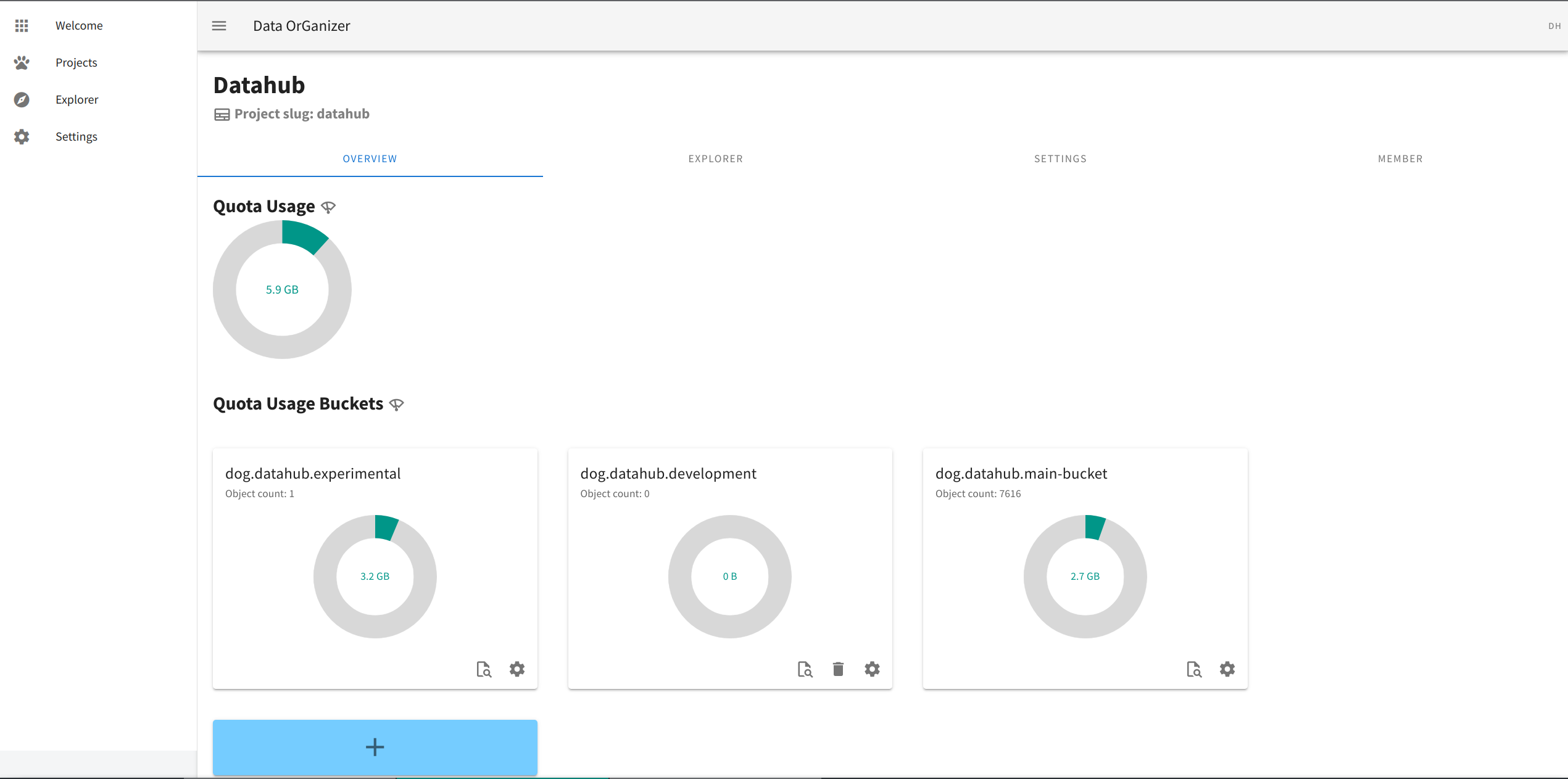
Der Data Organizer ermöglicht die Einführung moderner Speichertechnologien und die Nutzung zukunftsfähiger Speicherstandards als Grundlage, um große und stetig wachsende Mengen (un-)strukturierter Daten, Skalierbarkeit, eine nahtlose Integration zur Visualisierung und Analyse sowie die Anwendung von Data-Science-Methoden zu ermöglichen. Die dem Data Organizer zugrunde liegende Technologie wurde bereits im EQ Explorer eingesetzt. Auch die Verknüpfung mit dem Zeitreihen Management für eine nahtlose Visualisierung von Daten ist vorgesehen. Zukünftig wird der Dienst als Self Service für Wissenschaftler:innen angeboten.
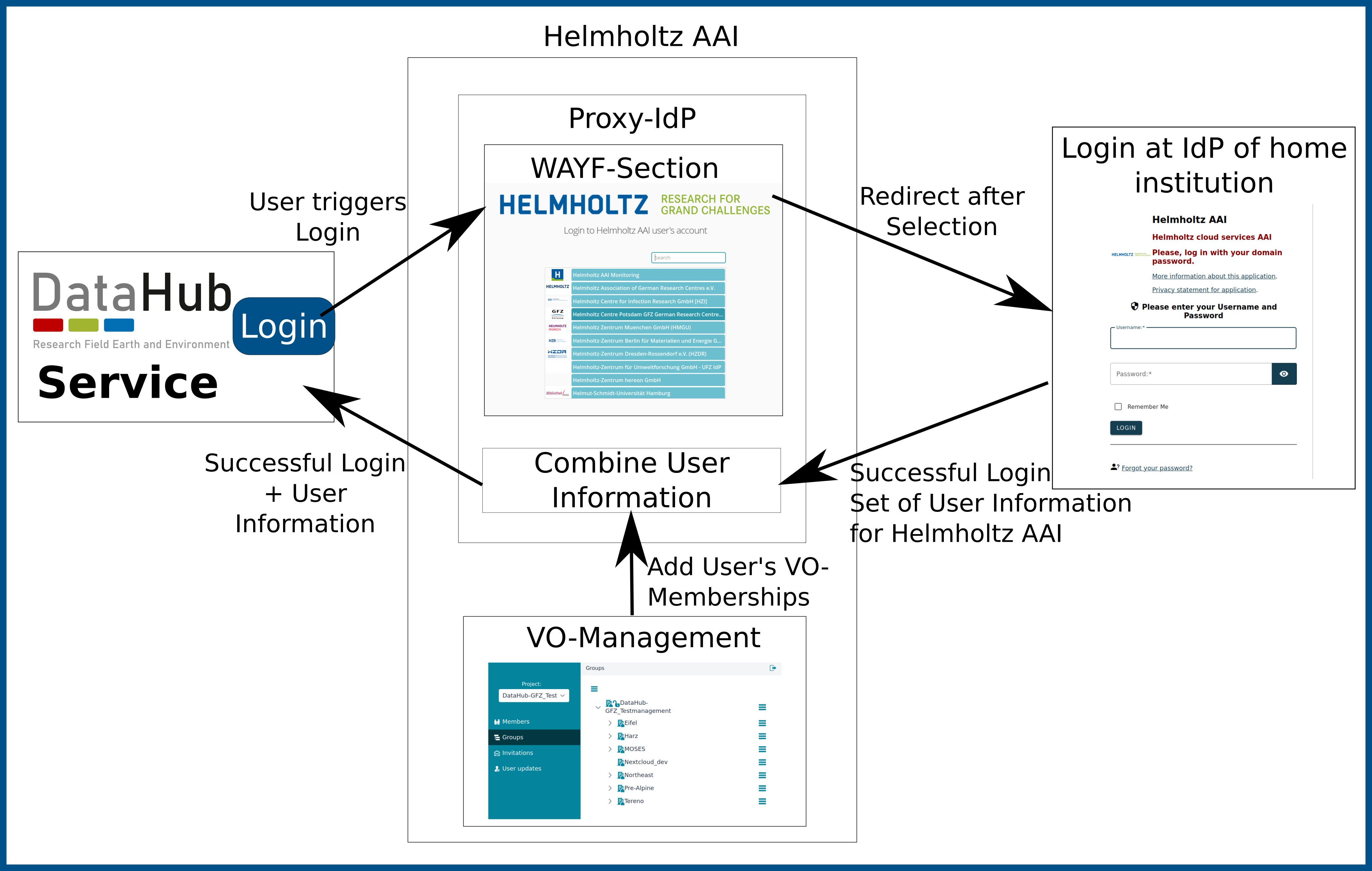
Für das Berechtigungsmanagement im DataHub werden sowohl Zentren-interne als auch Zentren-übergreifende Anforderungen berücksichtigt. Hierfür wird die Helmholtz-Authentifizierungs- und Autorisierungsinfrastruktur (AAI) eingesetzt, so dass Nutzer aus den Helmholtz-Zentren der Zugriff auf die föderierte DataHub-Infrastruktur mit seinen Werkzeugen und Diensten ermöglicht werden. Durch Erweiterungen werden für Zentren-übergreifende Lösungen virtuelle Organisationen der Helmholtz AAI genutzt sowie für Zentren-interne Berechtigungsmechanismen zusätzlich Informationen aus dem internen Gruppenmanagement der Zentren weitergeben.